Land Subsidence Research | Kathmandu Valley | Earthquake Vulnerability & Multi-Hazard Risk
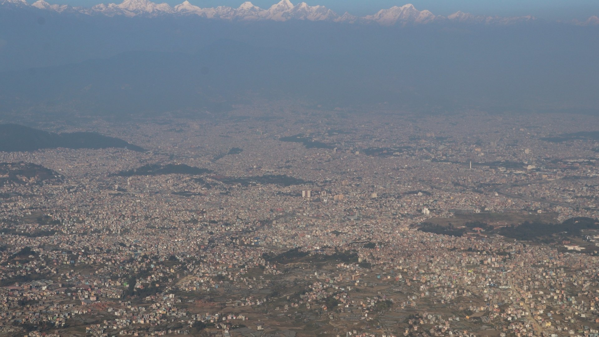
A recent study confirms what geologists have long feared: large areas of the valley are subsiding at alarming rates of up to 21 centimetres annually, driven by unregulated groundwater extraction and relentless urban sprawl.
The study conducted by Sagar Rawal and Guoquan Wang of the University of Houston, used seven years of satellite data from 2017 to 2024 to measure ground deformation across the valley.
“Rapid [urbanisation] in Kathmandu Valley has strained its aquifer system, causing significant land subsidence,” the researchers wrote. “These findings underscore the urgent need for sustainable groundwater management and land-use planning.”
Where the city is sinking fastest
High-resolution radar images from the Sentinel-1 mission identified several subsidence hotspots. The worst-affected zones include Baluwatar, Samakhusi, Lazimpat, Dhumbarahi, and Lainchaur in the northwest; Gwarko, Patan, and Koteshwor in the south; and Madhyapur Thimi, Gathhaghar, and Kaushaltar in the northeast.
On average, Baluwatar–Lazimpat–Lainchaur sinks about 10.7 cm annually, with some spots dropping up to 21 cm per year. Over seven and a half years, certain areas have dropped more than 1.5 metres. Even peripheral zones like Imadol and Bode–Duwakot are subsiding as concrete replaces farmland and open recharge fields.
Draining the valley’s lifeline
At the core of the problem is Kathmandu’s heavy reliance on groundwater. The valley’s aquifer system, once a natural reservoir of ancient lake sediments, has been overdrawn for decades.
Extraction increased from 2.3 million litres per day (MLD) in 1979 to 58.8 MLD in 2021, according to Kathmandu Upatyaka Khanepani Limited (KUKL). While the Melamchi Water Supply Project helped reduce the rate to 26 MLD in 2024, the damage has been cumulative.
The most affected areas sit atop thick layers of soft clay, silt, and sand. These materials compact when water is withdrawn. “These impermeable clay layers prevent rainwater from percolating down to recharge deep aquifers,” the study notes. “As the water table falls, the clay compresses, causing the ground above to sink.”
Cracks, sinkholes, and slow collapses
Subsidence is now visible. Residents report cracks in homes and roads, tilting walls, and sinkholes, especially in areas with deep tube wells. Photographs in the study document small landslides, fissures, and surface ruptures in neighbourhoods like Gwarko and Baluwatar.
The authors warn that creeping ground deformation could magnify destruction during future earthquakes. “If another large earthquake occurs, ongoing land subsidence will worsen the disaster, increasing structural collapses and economic losses,” the report cautions.
A glimmer of slowdown
Emerging Hot Spot Analysis shows subsidence has slowed slightly in high-risk areas after 2021, possibly reflecting reduced groundwater extraction since Melamchi’s operation. Still, subsidence is expanding east and south into Lalitpur and Bhaktapur, where new housing developments continue to replace open land.
From 1990 to 2020, the valley’s built-up area surged by 368%, the fastest urban expansion in Nepal. Each paved surface limits rainfall infiltration, starving the aquifers below.
Behind the science
The team employed Interferometric Synthetic Aperture Radar (InSAR), a technique that detects millimetre-level ground movement by comparing thousands of satellite radar images. Results were cross-checked with GPS data from the Nepal Academy of Science and Technology and a complementary radar method called Persistent Scatterer InSAR. The correlation confirmed the sinking trend with high precision.
What it means for Kathmandu
Subsidence threatens roads, bridges, water pipelines, and sewers. Combined with seismic shaking, the results could be catastrophic. Nepal ranks 11th in the world for earthquake vulnerability and 16th for multi-hazard risk, according to a UNDP report.
The study urges policymakers to enforce groundwater regulations, protect open spaces, and integrate subsidence risk into urban planning and building codes.
Kathmandu’s skyline continues to rise, but the ground beneath is gradually giving way. Without sustainable groundwater management and land-use reforms, the capital could face a dual crisis: a city rising in concrete but sinking in clay.
Read More Stories

NEPSE falls nearly 75 points as market sentiment wavers
The stock market was unable to maintain the gains seen on Tuesday, slipping...
India has begun its long-delayed population census. Here's why it matters
India has begun the worlds largest national population count, which could reshape welfare...

The United Nations has called on Israel to repeal a law passed by...

Business + Finance + Economy + Tech + Environment + Nepal & South Asia + In-depth Analysis + News + Investigation + Research + Expert Opinion + Anatomy of Complex Issues.